The Brief
• The Rattlesnake Ridge landslide has slowed dramatically from more than a foot per week in 2018 to less than three-quarters of an inch per month currently
• The slide threatens $40 million in annual crops and up to $60 million in agricultural land and infrastructure
• State officials now meet only twice a year to review data, indicating the slope is stabilizing as geologists expected
UNION GAP, Wash. — The massive landslide on Rattlesnake Ridge near Interstate 82 continues to move downhill, but at a significantly slower pace than when it first alarmed geologists and residents in 2017.
The Washington State Department of Natural Resources reports the slide now moves less than three-quarters of an inch per month, a dramatic decrease from its peak movement of more than a foot per week in early 2018.
“Frankly, no news is good news right now,” said Ryan Rodruck of the Department of Natural Resources. “When we say slowing down over the last few months, it’s slowed to moving less than three quarters of an inch per month.”
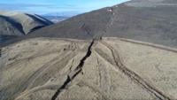
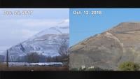
The landslide began due to natural geological conditions where heavy basalt rock layers slide over a weaker, slippery layer of sedimentary rock inclined at a 15-degree angle. This geological instability first gained attention in October 2017 when cracks appeared on the west side of Rattlesnake Ridge.
By December of that year, those cracks had deepened by hundreds of feet, raising fears that a major collapse could occur within weeks or months and threaten significant agricultural operations in the area.
The potential slide area encompasses more than 3,200 acres of orchards, vineyards, and irrigation systems with an annual crop value estimated at $40 million. The total value of land, orchards, and vineyards in the affected area ranges between $40 million and $60 million.
State officials responded by installing monitoring equipment to track even small changes in movement. Traffic along Interstate 82 was closely watched, and nearby residents received warnings about possible evacuations. The Columbia Asphalt and Gravel quarry halted operations in 2017 as a precautionary measure.
The dramatic slowdown has allowed officials to significantly reduce their oversight. DNR representatives now meet only twice a year to review the latest data on the slide, compared with the intensive daily monitoring during the landslide’s most active period.
“Geologists are continuing to monitor the slide—continuing to monitor the speed and motion—and hopefully will continue monitoring until it comes to a complete stop,” Rodruck said.
Despite the improved conditions, safety measures remain in place. The Washington State Department of Transportation installed large shipping containers that continue to line the closed section of Thorp Road, acting as barriers designed to catch rocks or small slides that break loose from the ridge. The road closure remains indefinite as officials wait for long-term stabilization before making infrastructure decisions.
The landslide has remained largely contained within the quarry area, but the economic impact extends beyond the immediate site. Similar landslides across Washington state cause “tens to hundreds of millions of dollars in annual damages,” according to a 2018 state report.
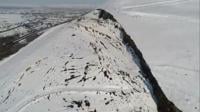
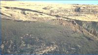
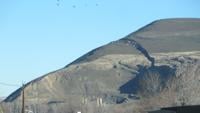
The landslide created a visible scar on the landscape that remains easily noticeable to drivers traveling along Interstate 82 near Union Gap. However, current monitoring data shows no indication of a sudden, catastrophic collapse.
All monitoring equipment indicates the landslide continues at a slow, steady pace, and officials say drivers along Interstate 82 are not in danger. The Department of Natural Resources will continue to monitor the slope closely until movement stops completely.
The gradual stabilization represents what geologists expected would happen over time, providing relief to a community that once faced the possibility of immediate evacuation and major infrastructure damage to critical agricultural operations.





COPYRIGHT 2026 BY APPLE VALLEY NEWS NOW. ALL RIGHTS RESERVED. THIS MATERIAL MAY NOT BE PUBLISHED, BROADCAST, REWRITTEN OR REDISTRIBUTED.
Credit: Source link